The XC Package
If you have purchased the XC Extension, then the following new instruments are available for you, and can be placed anywhere on the fly-screens. In addition to the new instruments, the XC Package also determines when you are thermaling, and your general flight direction outside of thermals. This general flight direction is indicated as a cyan coloured line on the normal map instrument. The line also shows where you will likely hit the ground with the current glide ratio in that direction.
The general flight direction is also used for the side view, showing the landscape along that direction. That way, you can still see what lies ahead even while thermaling.
The general flight direction is also used for the side view, showing the landscape along that direction. That way, you can still see what lies ahead even while thermaling.
Thermal centring
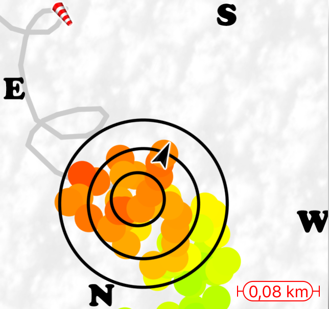
A visual image is shown of the current thermal, in vivid colours. The weak parts of the thermal are shown in green colour, stronger parts in yellow, and the strongest core is shown in red (> 4 m/s). The circles show the estimated centre of the thermal. All indicators are shown where they are likely to be at your current altitude. That is, the effect of the wind on the thermal, the thermal drift is already taken into account.
The thermal centring tool also shows the wind direction, compass indicators, airspaces (with the Airspaces Extension), and other normal map annotations.
When enabled in the Settings, the app will switch automatically to the page with the thermal centring tool when entering the thermal, and back to the previous page when exiting.
Distance from takeoff
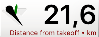
The instrument shows the straight-line distance from the takeoff location, and the direction to it.
Side view
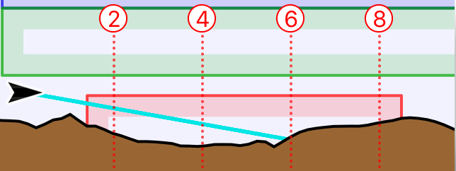
A side view shows the landscape ahead along your general flight direction. Your expected glide line indicates where you will likely hit the ground. With the Airspaces Extension, the airspaces that you will encounter along that direction are also shown.
Current triangle
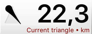
The Triangle instruments are useful when you are trying to fly a FAI triangle. The Current Triangle instrument shows the direction you need to fly to close the triangle, and how large it will be if you do so. The arrow will turn green if you have closed the triangle according to the XContest rules, that is, if the smallest gap between start and finish is less than 20% of the triangle size. The size indicated by the instrument assumes that you will be able to reduce that gap to zero.
Possible triangle
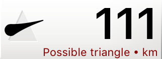
The Possible Triangle instrument gives a suggestion of a triangle that you could reasonable try to achieve given your flight track so far. It shows how large that triangle can potentially become, and which direction you roughly need to fly to achieve that. The potential triangle is continously recomputed, so it will challenge you to bigger and bigger triangles.
Note that FAI triangle sectors of the same potential triangle are shown on the normal map instrument.
Note that FAI triangle sectors of the same potential triangle are shown on the normal map instrument.
Free distance
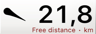
The instrument shows the current free distance of your flight, and the direction to fly towards to enlarge it. The free distance is the distance calculated over 5 points, the same distance as given in the scoring details of a flight.
GPS Altitude
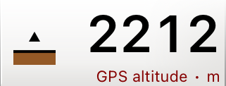
The GPS Altitude instruments always shows the altitude data that is coming from the GPS source. That is normally the GPS in the phone. But the GPS data is taken from a connected Bluetooth vario, if “Use device GPS” is enabled for that vario.
Just like for the normal Altitude instrument, with the Airspaces Extension, your vertical position with respect to airspaces is shown on the left. In this case, the airspace limits are compared to the GPS altitude.
Note that the alitude is taken directly from the GPS data. This may sometimes differ substantially from the barometric altitude and may show erratic behaviour at times.
Wind (Bluetooth)
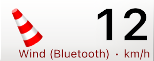
This instrument shows the wind speed as reported by a connected Bluetooth device. The windbag on the left gives the wind direction. It rotates with your heading, so it is always clear where the wind is coming from at a single glance. In the example on the left, the wind is coming from the back, and the right.
If the Bluetooth device does not report any wind data, the instrument will remain empty.
The normal wind instrument, and the wind direction depicted on the map, are always calculated from all available data instead.
If the Bluetooth device does not report any wind data, the instrument will remain empty.
The normal wind instrument, and the wind direction depicted on the map, are always calculated from all available data instead.
Temperature
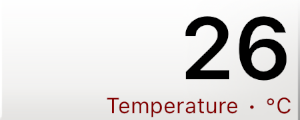
It shows the air temperature, as reported by a connected Bluetooth device. If the Bluetooth device does not report any temperature data, the instrument will remain empty.